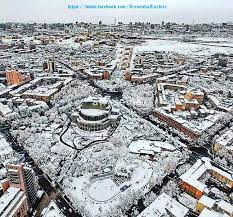
Iravan neighborhoods
Iravan until 1828, Erivan from 1828 to 1936.
Yerevan since 1936.
Architecture
Since Armenians settled in Iravan from the beginning of the 19th century, the Armenian neighborhoods surrounded the Azerbaijani neighborhoods like a ring. In the 1950s and 1960s, the neighborhoods where Azerbaijanis lived compactly and their ancient cemeteries were destroyed under the pretext of building new buildings.
Iravan city consists of the following parts: 1. City part 2. Tapabashi part 3. Damirbulag part. The largest part – City part covers the north-eastern area of Iravan; Tepebashi part holds the western part, and Damirbulag part holds the southeastern part. These parts also include the following additional neighborhoods with their own special names: Those belonging to the City part: 1) Abbasdara neighborhood located below the village of Chokmakchi; 2) Koshakli neighborhood located on the right side of Kanakir road; Those belonging to the Tapabashi part: 1) Abihayat neighborhood located on the left of Kanakir road; 2) It was located to the left of the Zangi river, below the village of Kanakir. According to the Ottoman "Detailed notebook" compiled in 1728, Iravan city consisted of 4 districts ("Old City", "Damirbulag", "Darakand", "Tapabashi"') during this period. After becoming the center of the independent khanate, "Old City" neighborhood was called "City" neighborhood, and "Darakand" was merged with "Tapabashi" neighborhood.
Iravan city neighborhoods bore the material and cultural traces of the Azerbaijanis in the city of Iravan. The fact that most of the settlements, streets, neighborhoods are in Azerbaijani Turkish once again shows that this area was one of the ancient settlements of Azerbaijanis.


